Module 5
AQUARIUS Time Series Software
Description: This module explores the use of the AQUARIUS software to model changes in hydrological parameters over time. Topics covered include types and components of a hydrological time series, data correction practices, and data analysis and statistics.
Module 4

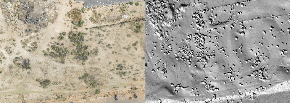
Structure-from-Motion (SfM) and Multi-Stereo-View (MSV) for 3D Terrain Modeling
Description: This module surveys the practice of applying the SFM and MSV techniques to process multiple aerial photographs into an orthomosaic, which can be subsequently used as a map or used to create a three dimensional surface model. Topics covered include stereo vision, relief displacement, aerial triangulation, and SfM-MVS.
Module 3
Geometric Rectification
Description: This module covers the steps involved in correcting the planimetric positioning of features within satellite imagery as a necessary pre-processing step for later analysis. Topics covered include image-to-map rectification, image-to-image rectification, ground control points, and interpolation methods.
Module 1

Supervised Classification for Land Use / Land Cover Mapping
Description: This module explores the process of identifying and categorizing land cover types in a satellite image using a computer algorithm calibrated upon a large base of pre-defined training data. This is followed by an investigation of various accuracy assessments associated with this classification method.
SUPERVISED CLASSIFICATION DOWNLOAD