- You are here:
- Home

- Facilities and Equipment
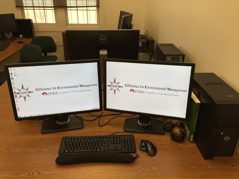
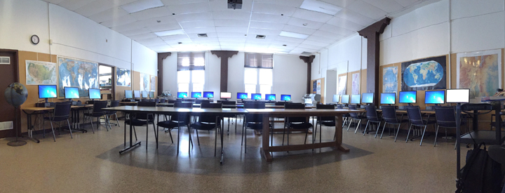
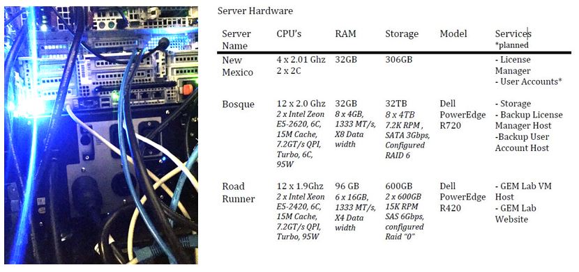
The GIScience for Environmental Management (GEM) Laboratory, located at Bandelier East Hall 106A, is equipped with a state-of-the-art computer lab for GIS and Remote Sensing applications. The lab contains 4 student workstations with dual 24" monitors and one processing workstation with a 30" 4K ultraHD monitor. The GEM Laboratory also operates 2 servers (See Server Hardware List Below) to enhance data processing and data management capabilities. The primary software used in the GEM Lab for research are ArcGIS, ERDAS Imagine, Agisoft, Menci APS, ENVI, and IDRISI.
Data Acquisition
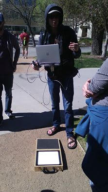
Recently, in cooperation with UNM Department of Anthropology, the GEM Lab also purchased a Real-Time Kinematic (RTK) GPS system and associated software. The RTK GPS system will support ongoing research into the use of structure-from-motion techniques for 3D surface height characterization through collaboration with Department of Anthropology, Civil Engineering, and Biology, in addition to providing a state-of-art research and teaching tool to students in Geography and Environmental Studies.
The Trimble R10
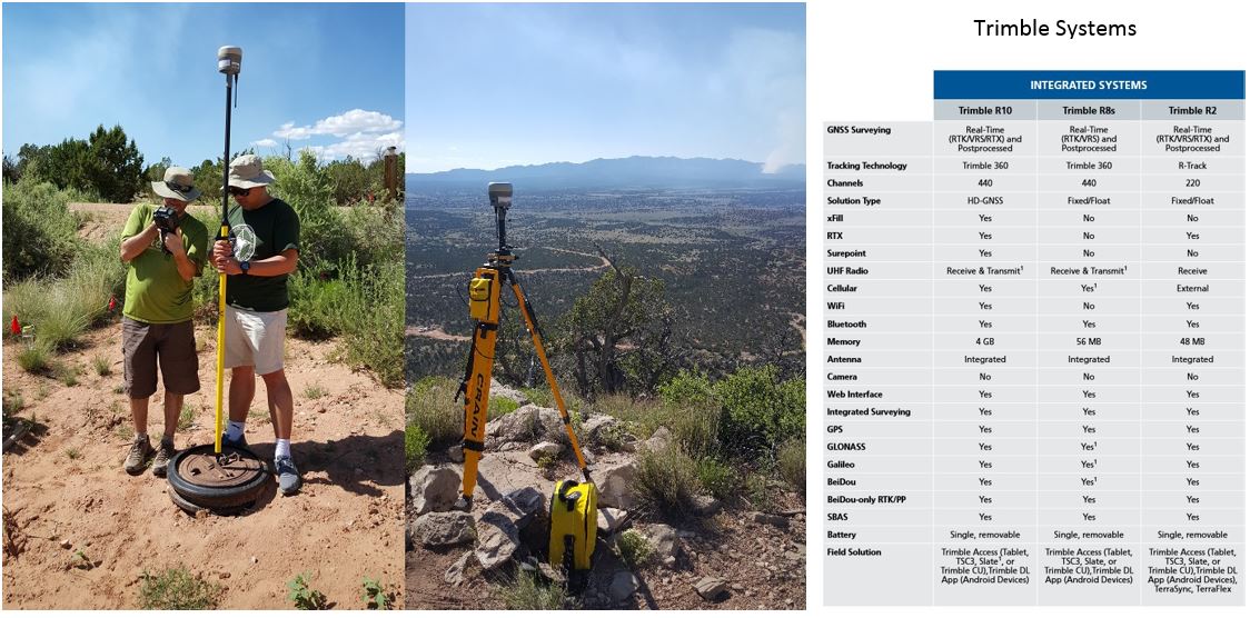
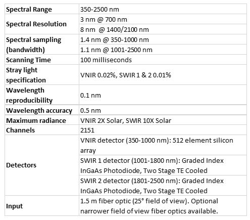
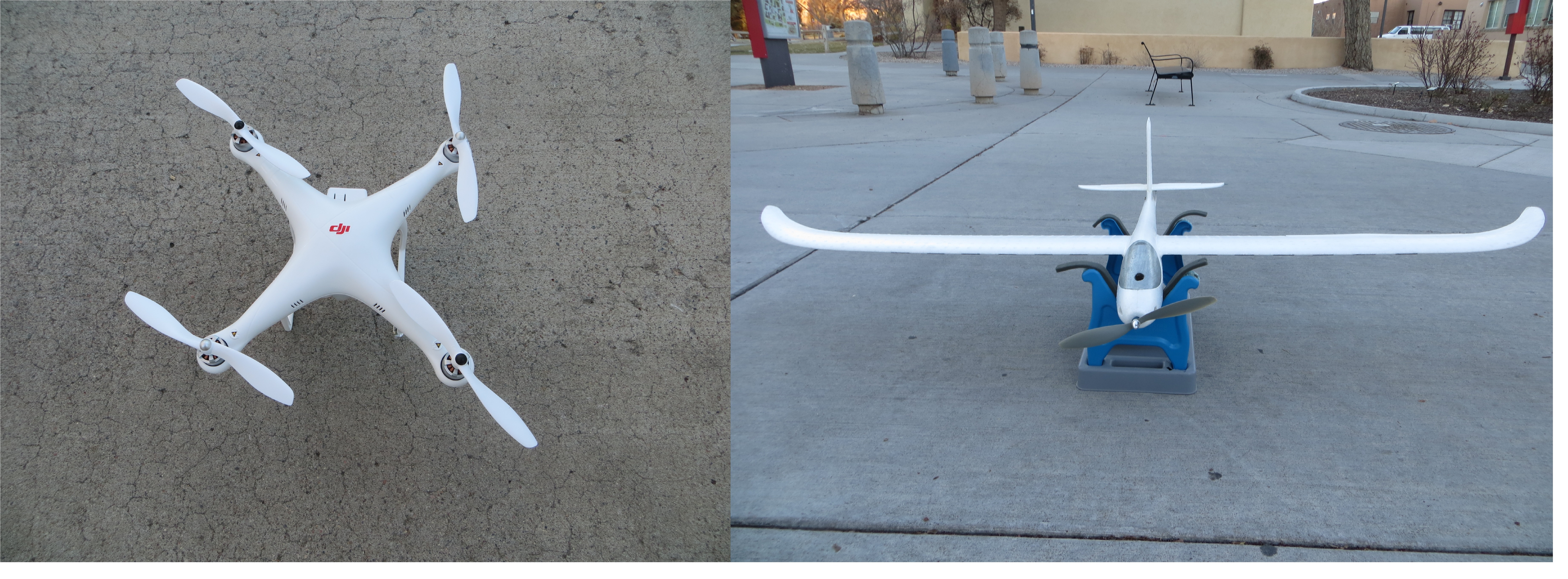
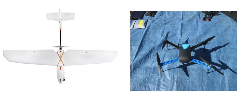
Coupled with Unmanned Airborne Systems (UAS), the GIScience for Environmental Management (GEM) Laboratory has the capability to acquire high-spatial resolution (1-inch to 6-inch) aerial imagery and hyper-spatial resolution (1-millimeter to 1-inch) aerial imagery at a low-cost. With the aid of the Real-Time Kinematic (RTK) GPS system, the GEM Lab also has the capability to acquire high-accurate ground control points (GPCs). The GEM Lab also has a full-range ASD field spectrometer and associated software. With the help of the full-range spectrometer, the GEM Lab has the capability to detect spectral lines and measure their wavelength or intensity.
Unmanned Aircraft Systems (UAS)
The ASD Inc. FieldSpec 4 Hi-Res