This project is funded by the Research Allocation Committee at the University of New Mexico.
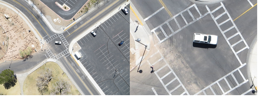
In the aftermath of a natural disaster, it is critical to evaluate the condition of infrastructure systems so that first responders can have access to the affected areas and officials can identify potential safety hazards. The need for maintenance of infrastructure similarly requires the routine monitoring of infrastructure status. Traditional assessment practices deploy engineers to perform on-site evaluations or airplane observations to evaluate areas that are inaccessible. These approaches have limitations in terms of lack of detail for the airplane-based observations and lack of accessibility for on-site observations, not to mention the cost of deploying observers to vast road networks. We therefor evaluate the use of unmanned remote sensing systems (URSS), which can fly lower to the ground than traditional airplanes, and thus, allow for detailed data to be collected without specially-designed, cost prohibitive sensors. Using roadway pavement assets as an example, this research explored the utility of hyper-spatial resolution (3-millimeter) multispectral digital aerial photography acquired from a low-altitude and low-cost URSS, in this case, a tethered helium weather balloon, to permit characterization of detailed pavement surface distress conditions.
PI: Dr. Susan Bogus Halter; CO-PI: Dr. Christopher D. Lippitt
Research Assistant: Su Zhang
August 2013 – March 2015
Amount: $9,040
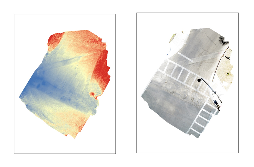
Using hyper-spatial resolution images as input, aerial triangulation (AT) is used to generate the digital surface model (DSM) and orthophoto of the pavement segment.