This research, funded by United States Department of Transportation (USDOT) Office of the Assistant Secretary for Research & Technology (OST-R) Commercial Remote Sensing and Spatial Information Technologies Program (CRS&SI), is developing an operational prototype for the rapid detection of fine scale damage to transportation infrastructure following natural hazard events. Lead by Dr. Chris Lippitt of UNM Geography and Environmental Studies, the project team includes the University of New Mexico (Co-PI Dr. Susan Bogus-Halter of Civil Engineering), San Diego State University (institutional-PI Dr. Douglas Stow) and BAE Systems Inc, makers of the Socet GXP® line of image exploitation software. The project team is building on previous research and patent pending technology to design a complete remote sensing system catered to the needs of New Mexico DOT (NMDOT) and USDOT’s infrastructure assessment needs. Approaches developed through the project will be incorporated into the Socet GXP® line of desktop, server, and mobile applications for image exploitation and will be demonstrated in Albuquerque, NM. Ultimately, the project seeks to make available the latest in precision change detection and user optimized remote sensing systems to USDOT for operational assessment of damage to transportation infrastructure following hazard events.
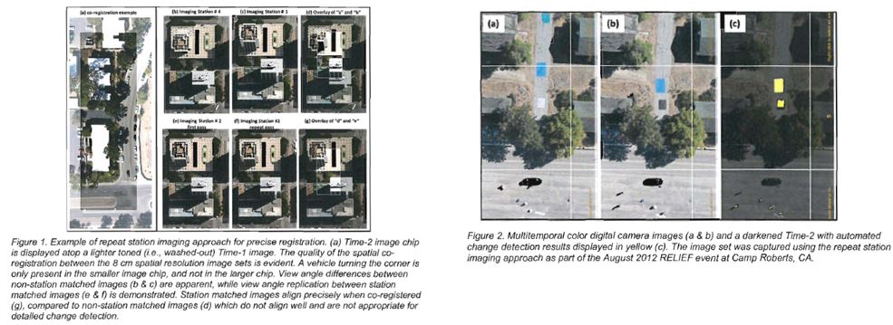
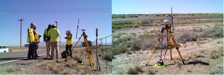
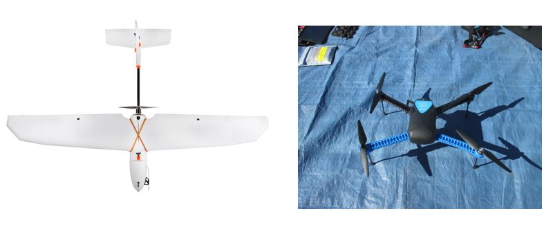
Effective response to natural disasters can help preserve human life and property. Major hazard events can create dangerous situations that are extremely time-sensitive; the first 24 hours are often the most important. Short time-frame damage assessments (sometimes over large urban areas) can be difficult with the current conventional, ground-observations and sensor networks. The solution to this post-hazard information access challenge is to design flexible, ready-to-deploy, time-sensitive remote sensing systems (TSRSS) based on a network of airborne platforms and digital cameras (manned in the near term, but eventually an unmanned aircraft). Our team has conducted extensive research and development on an image-based infrastructure assessment model that utilizes fast and precise data collection and processing within those critical time frames. We use a novel approach called repeat station imaging (RSI, previously known as ‘frame center matching’) to rapidly align and analyze images for detection of fine-scale damage to infrastructure.
In the News
In the context of anticipated ubiquity of unmanned airborne imaging (i.e., drones), the potential for successful deployment of TSRSS for infrastructure management, particularly those being developed through this project, is beginning to receive recognition in the popular media. Follow the links below to learn more.
http://news.unm.edu/news/unm-researchers-take-to-the-skies-to-assess-infrastructure-damage
http://newscenter.sdsu.edu/sdsu_newscenter/news.aspx?s=75413
Referred Journal Articles – Published
1. Zhang, S., Lippitt, C. D., Bogus, S. M., Loerch, A. C., and Sturm, J. O. (2016). “The accuracy of
aerial triangulation products automatically generated from hyper-spatial resolution digital aerial
photography.” Remote Sensing Letters, 7(2), 160 – 169.
Conference Proceedings – Published
1. Zhang, S., Bogus, S. M., and Lippitt, C.D. “Infrastructure condition assessment based on low-cost
Ultrahigh spatial resolution multispectral digital aerial photography”. Proceedings of the 2015
International Construction Specialty Conference , Vancouver, British Columbia, Canada, 1–10.
Presentations
1. Zhang, S., Lippitt, C.D., Bogus, S.M., and Zhang, G. Quantifying the Impact of Road Lighting
Conditions on Nighttime Vehicle Crash Rates Using Nighttime Light Satellite Imagery . Transportation
Research Board 95th Annual Meeting, January 10 – 14, 2016, Washington, D. C.
2. Zhang, S., and Lippitt, C.D. 2015. Infrastructure Condition Assessment based on Low-cost Hyper-
spatial resolution Multispectral Digital Aerial Photography . 2015 SWAAG-AGC Joint Meeting,
November 4 – 7, 2015, San Antonio, TX.
This project is funded by the U.S. Department of Transportation cooperative agreement # OASRTRS-14-H-UNM
![]()
![]()
![]()