Introduction
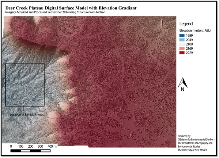
The imagery collected from the Dear Plateau covers nearly 30 km2 of variable terrain, including cliffs, basins, and plateaus. The area is covered in piñon, juniper, and other herbaceous vegetation. The aerial acquisition of images from this site was conducted using an ultralight aircraft and two Canon 5D Mark II cameras, one with Blue, Green, and Red bands and the other with a filter to pass only near-infrared wavelengths.
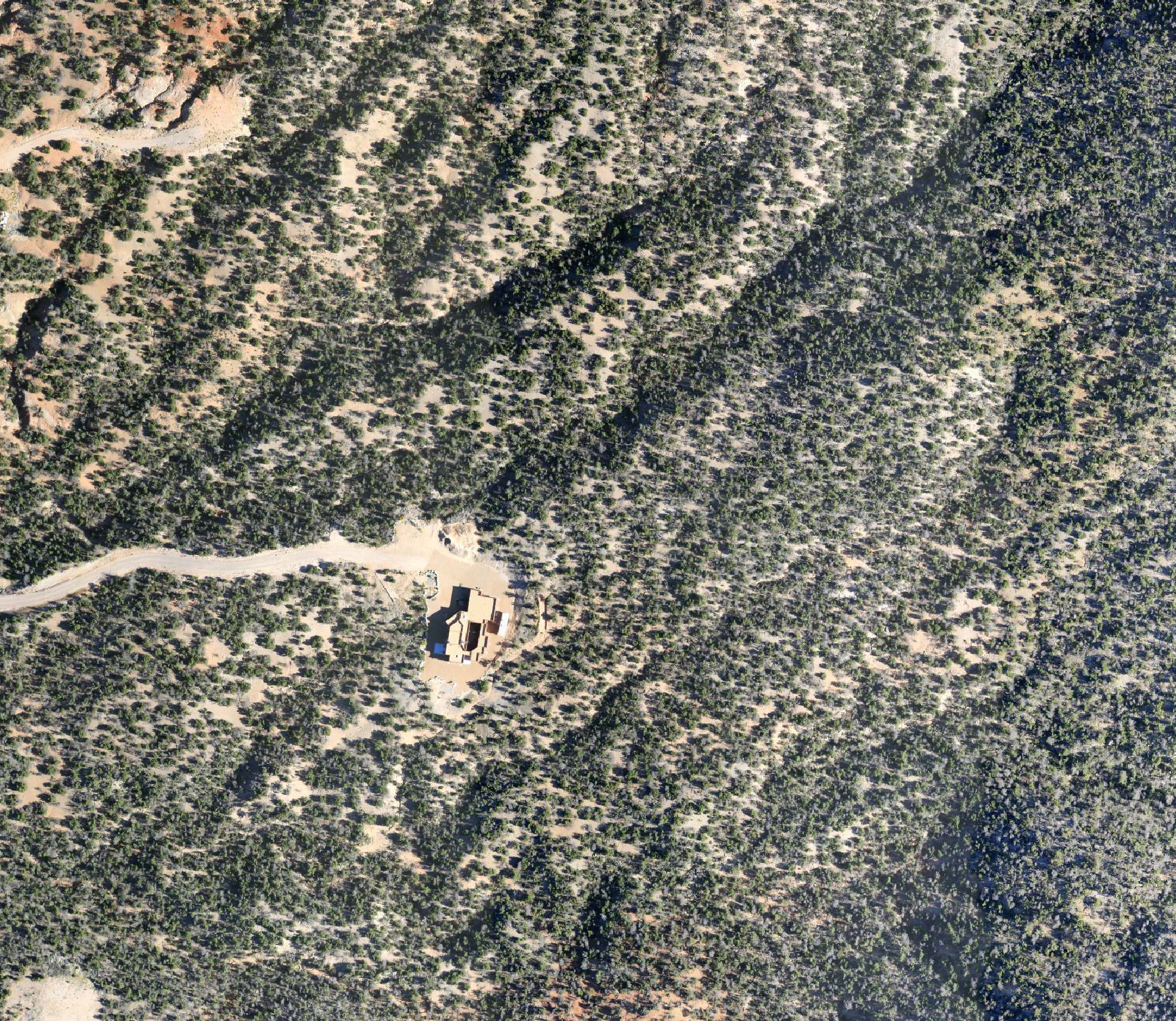
Natural Color Orthoimage Tile
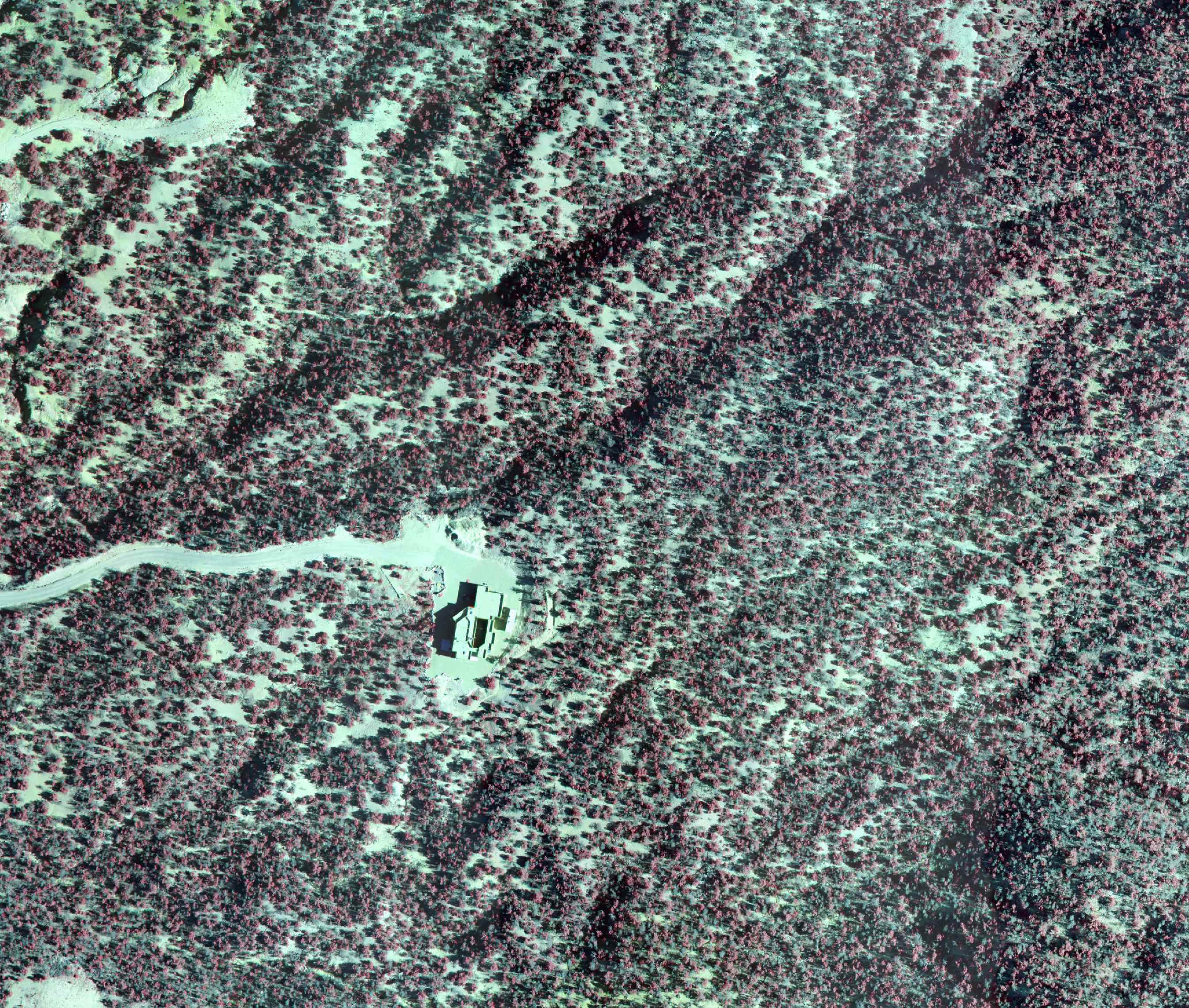
Color-infrared Orthoimage Tile
The Process and Results
|
Structure from Motion: Digital Terrain Models |
Sensor / Input Imagery Data
|
Digital Surface Model and Orthoimage Data
|
|
Structure from motion is similar to traditional aerial triangulation for creating digital elevation models from overlapping images. The process used with Deer Creek Plateau involved taking 6,864 images of the area, with ~70%-80% front and side-overlap, and generating 3-dimensional point clouds of pixels matched between images. This process produced digital terrain models of the area with vertical accuracy of 1.5-3cm sampled at 35cm spatial resolution at a fraction of the cost, and at higher spatial-resolutions, than commonly used LiDAR methods.
|
Image Format: Multi-band Tiff Bands: Blue, Green, Red, Near-infrared Radiometric Resolution: 24-bit Image Sensors: 2x Canon 5D Mark II Sensor Dimensions: 36 mm x 24 mm Pixels per Frame: 5616 x 3744 Focal Length: 50 mm Ground Sample Distances per Image: 0.050 m – 0.090 m Total # of Images: 6,864 (3,432 images per camera) |
Output Format: Multi-band Tiff Bands: Blue, Green, Red, Near-infrared Radiometric Resolution: 8-bit Ground Sample Distance: 0.070 m Digital Surface Model Resolution: 0.350 m Orthophoto / Digital Terrain Model Height: 6179 m Orthophoto / Digital Terrain Model Width: 4800 m Total Covered Area: 29.7 km2 # of Orthophoto Tiles: 500 (optional) Estimated Vertical accuracy: 1.5-3cm |
Sample Map #1
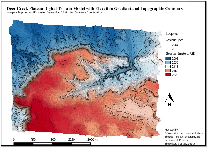
Sample Map #2